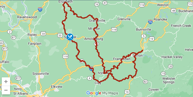
With each EOM event, there are usually suggested ride routes that provide attendees with day ride loops based out of the host hotel. These ride loops are compiles from suggestions provided by local members or others who frequent the area. The ride loops are created in Garmin Basecamp and available in the “GPX” format used by Garmin Zumo GPS units.
All GPS routes were compiled with the Garmin Basecamp mapping program using a version 2022 Garmin map. Routes on your GPS should be calculated with the user setting “fastest time”. A GPS can have problems when a route begins and ends on the same road so some routes begin or end on a branch road. Though every effort was made to create accurate routes no claim is made to their validity. GPS routing is an inexact affair, maps contain errors and roads are subject to construction, closure and other problems.
The free Kurviger routing web site, https://kurviger.de/en/ among others, can be used to display GPX route files and/or convert to other formats.
Disclaimer – GPS routes are provided at no cost to FJR1300 Eastern Owners Meet Rally participants, download and use at your own risk.
Lastly, The EOM route file is typically published and available for download from this website by September 1st each year. The file is made available for EOM guests during the month of September each year.